
Nightfox Aerial
Drone photography, aerial inspections and rural property imagery for farms, worksites and regional land.LOCAL· PRACTICAL · DETAIL-FOCUSED
Overview
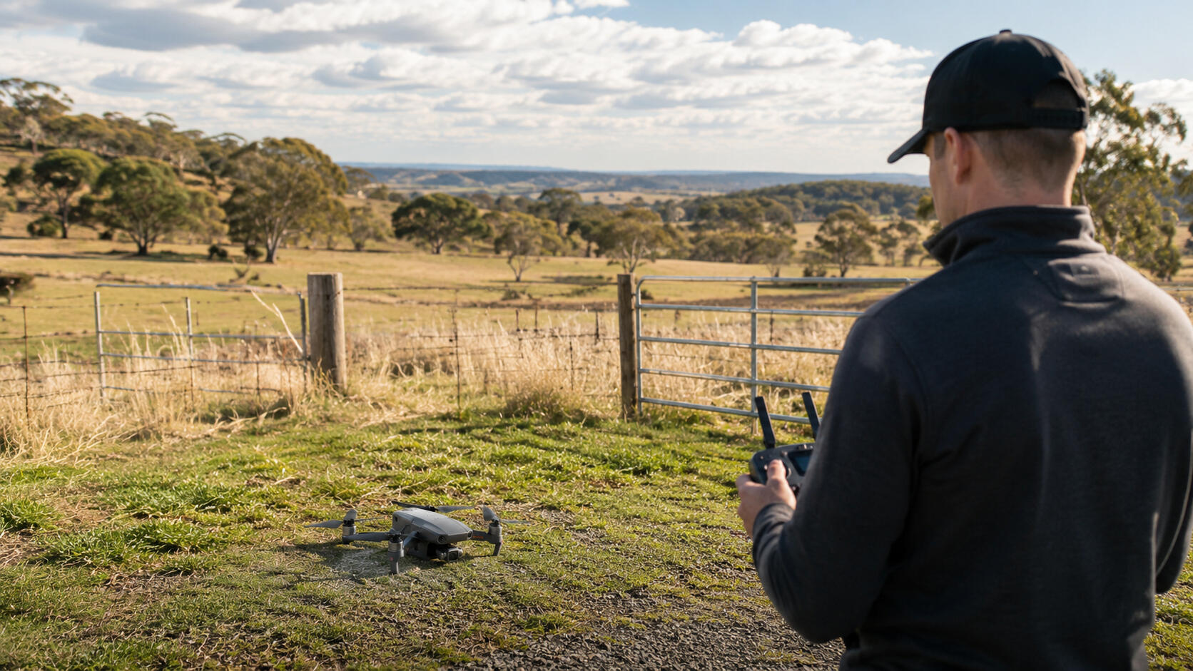
Nightfox Aerial provides drone-based imagery and inspection support for farms, rural properties, buildings, assets and worksites across the Geelong, Moorabool and surrounding regions.Whether you need aerial photos, property views, progress updates or a closer look at hard-to-reach areas, each job is planned carefully, flown safely, and delivered with clear, useful results.From simple aerial photos through to visual inspection support, the focus is on capturing useful images that help you see the property, asset or site clearly.
Services
Nightfox Aerial can assist with:Aerial Photography & Video
High-quality drone imagery for properties, farms, businesses, projects and promotional use.Farm & Rural Property Imagery
Wide-area views of paddocks, fencing, sheds, access tracks, dams, tree lines and property conditions.Roof, Solar & Asset Inspections
Visual inspections of rooftops, gutters, solar panels, sheds, towers and other hard-to-access areas.Construction & Progress Updates
Before-and-after imagery, site progress photos and aerial records for worksites or property improvements.Future Capability
Crop insights, mapping and advanced reporting services are planned as Nightfox Aerial continues to grow.
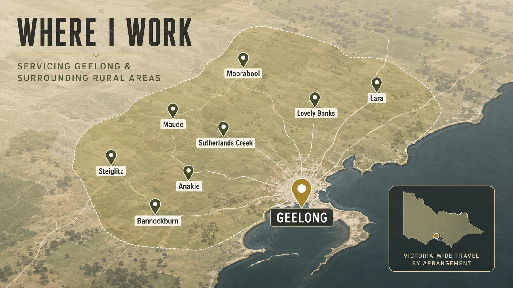
Where I Work
Based near Geelong, Nightfox Aerial provides drone services across surrounding rural and regional areas including: Moorabool region, Maude, Sutherlands Creek, Steiglitz, Anakie, Lovely Banks, Bannockburn, Lara and nearby locations.For jobs outside these areas, please get in touch and I’ll confirm availability.With enough notice and planning, I am generally happy to travel Victoria wide
How It Works
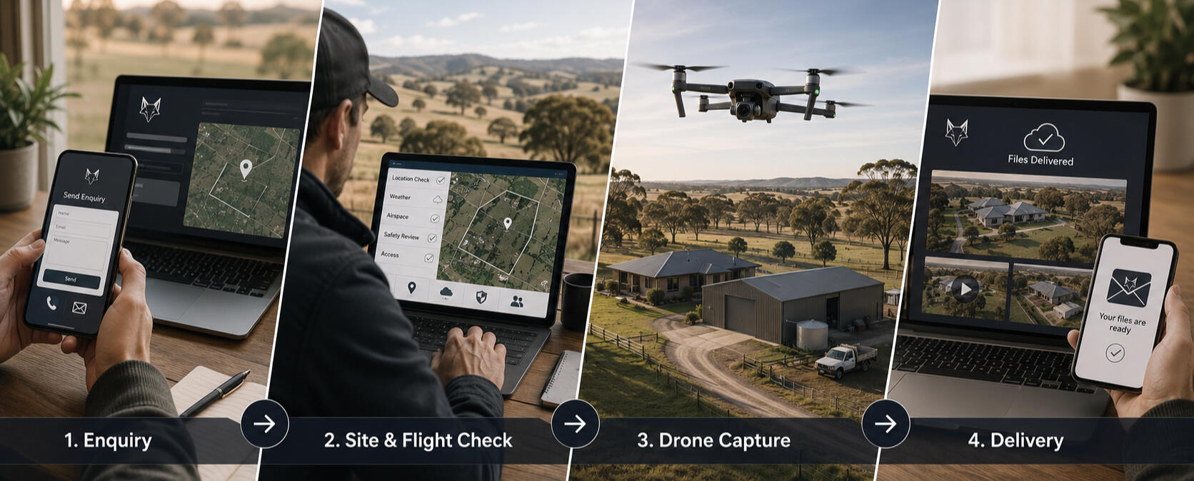
1. Send an enquiry
Tell me the location, what you need captured, and what the images will be used for.2. Site and flight check
I’ll review the location, access, weather, airspace, safety considerations and suitability before confirming the job.3. Drone capture
The flight is completed safely and methodically, with attention to the shots or inspection areas required.4. Delivery
Images, video or other agreed files are provided digitally after the job.
Enquiry received
Thank you for your message.Your enquiry has been received and I'll review the details before getting back to you.